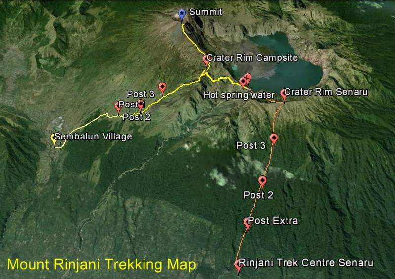
Find your path to the summit with our Mount Rinjani Trekking Map. It highlights the classic routes from Sembalun (summit route, 3,726 m) and Senaru/Torean (lake route), key waypoints (Pos 1–3, Pelawangan crater rims), Segara Anak Lake, and the hot springs. Use it to preview daily distances, elevation gains, camp spots, and estimated hiking times—so you can plan safely and trek with confidence.